

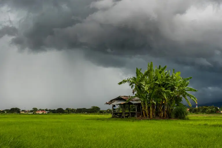
Cool oceans. Westerly winds. Mild winters. Mild summers. Overcast skies and rain year round. It might not seem the picture of an ideal place to live, but these lands harbour many world famous European cities, spawned not one but three global empires, and have influenced agriculture around the world more than any other. These are the lands of the Marine West Coast, the lands of the Oceanic climate.
Climates
The Mediterranean Climate

The world’s most famous sea. And to many, the world’s favourite climate. Hot dry summers and wet winters – the Mediterranean Climate blesses the ancient lands of Spain, Italy, Greece, Turkey and Israel, but is also duplicated in far off lands, including the Pacific North-West of the USA, California, Chile, South Africa and Western and South Australia.
The Humid Subtropical Climate


New York is Subtropical. Really? According to the Koppen Climate Classification, it has the same Humid Subtropical Climate as New Orleans in the Deep South. Sounds crazy, doesn’t it? And what...

Microclimates – dramatic shifts in temperature, rainfall or both over just a few kilometers or miles. How are these sudden shifts possible. In this video I look at the five basic types of...

Seasons – Origin and Variation Across Earth. Types Of Seasons by Climate Zone There are various types of seasons on this earth, determined by which climate zone one is in. In this video, I will...
The Hot Desert Climate

THE HOTTEST PLACES on our earth. The deserts of the subtropical regions. In this video we show these parts of the world and why they are that way.
From the Mojave, Sonoran and Chihuahuan deserts of south-west United States and northern Mexico, through the arid coast of Peru, and the Gran Chaco of north-west Argentina, the Americas feature unique biomes of aridity and heat.
The largest of all deserts, the Sahara, spanning the vast northern stretches of Africa, and continuing east into the Horn of Africa and the Middle East and beyond into southern Iran, Pakistan and western India – the central continents of Earth have the greatest areas of hot and dry lands anywhere on the planet.
In southern Africa, the Namib and Kalahari deserts offer a counterpoint to their much greater northern brother.
Lastly, the majority of the “island continent” is covered by the endless plains of the Red Heart of Australia, and the Outback – the Great Sandy, Victoria and Gibson deserts.
Subtropical Highland Climate

In the mountains and valleys of the tropics, a special place awaits… An escape from the heat and humidity of the surrounding lands… Spectacular scenery, great cities, and legendary empires of old. And the place where your favourite drinks are born. Welcome to the Subtropical Highlands, and their climate of perpetual spring!
The Tropical Monsoon and Tropical Savannah Climates

The monsoons and savannahs of the tropics – home to billions of us on Planet Earth, where the tropical heat is near-constant, and where the seasons are defined by rain and drought.
From the Caribbean and Brazil, through the endless savannah of West and East Africa to southern India and South-East Asia, the tropical wet and dry climates stretch all around the equatorial zone, encompassing huge populations.
The Tropical Rainforest Climate

The Tropical Rainforest Climate, also known as the Equatorial Climate. A place of steamy jungles, and the rainforest after which the climate is named.
When you think of the equator, Indonesia and Malaysia, the Amazon river basin, Borneo, Java, Bali and the Congo of Central Africa then you are thinking correctly, for these are the places in the world where such a climate exists.
A place of no seasons, this is the tropical rainforest climate where every day is hot, and where heavy rain occurs throughout the year.
What Is the Köppen Climate Classification System? Global Zones Made Simple

The 2025 monsoon is shifting from southwest to northeast after one of the wettest seasons in years. Discover why it was so intense and what comes next...

When floods or other natural disasters occur, every minute matters. Today, rescue teams have eyes from above, using satellite imagery, drones, or helicopters. As a result, they get a clear picture of...

The Amazon Rainforest: Its Past, Present, and Future https://www.youtube.com/watch?v=OcI1FlQOu54 The Amazon Rainforest. Raw, wild and absolutely essential to life as we know it. It is one of the most...
The Pacific North West Climate
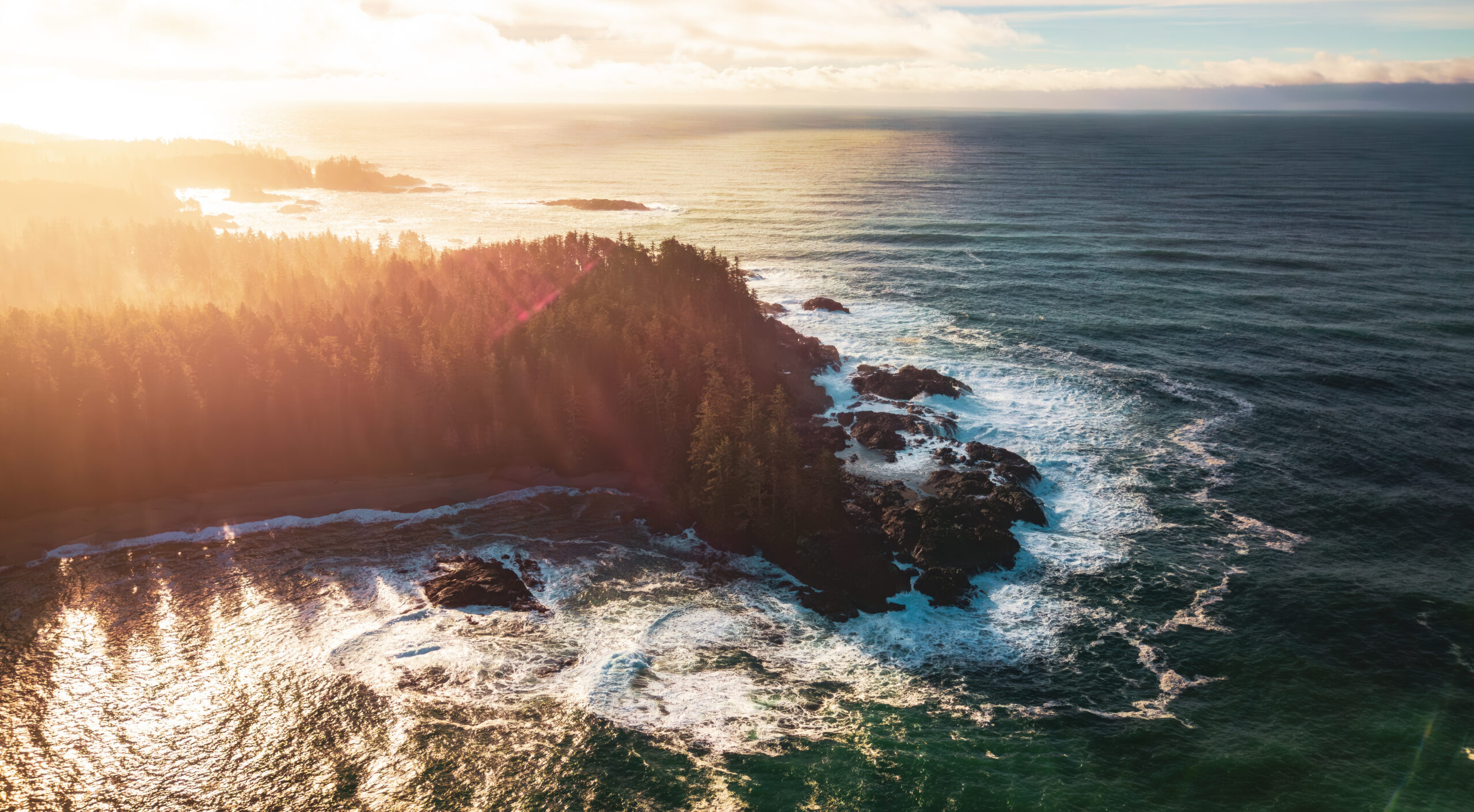
The Pacific North West of the United States and Canada. A wonderland of nature. Epic scenery – breath-taking mountains, endless forests, windswept beaches, even volcanoes. And amazing cities that have influenced the wider world far beyond their isolated patch along the wild Pacific coast. And… it is somewhat well known for its weather too. Dominated by wet winter westerlies blowing in from the Pacific each year, its exposed coasts feature some of the highest rainfall in the world, and sport temperate rainforests.
So when I briefly touched on this region in my Secrets of World Climate Series in the Mediterranean chapter, it created some controversy. “No way that’s Mediterranean! It’s Oceanic, Maritime West Coast, like Britain and Ireland!” And, like so many others, I have to confess, I had thought the same before I did my research into that series. So I thought I should devote an article to the Curious Case of The Pacific Northwest Climate, in this, the first of the cases, in my Climate Casebook.

Location of the principal cities of the Pacific Northwest
So the wet winters of the Pacific NW are pretty well known. It’s also fairly well known that Vancouver has the mildest of all winters out of all the Canadian cities. But much fewer people know about the summers in this area.
Having lived, myself, for many years in the Mediterranean climate of Southern California and South Australia, and the Oceanic climate of Britain, I have a very strong understanding of these two climate zones borne of direct experience backed by my own research. Yes, it’s undoubtedly obvious to anyone who knows a little of geography, that those Mediterranean areas are significantly warmer than Britain, both in winter and summer. That’s one distinction. The other, still fairly well known distinction is that those Mediterranean areas have dry summers. For most of the years I lived there, I could remember most summers where it did not rain for 4, 5 or even 6 months at all. To go without rain for even one month in Britain at any time of year is unusual, which was what made the British summer of 2018, where it was sunny every day and without rain for two months, all the more remarkable.
Britain is famous for its rain, very much so, in fact. And because Seattle, Portland and Vancouver are too, and because they lie at a similar latitude facing west to an ocean, the assumption is that they must have the same climate. An assumption I also once made.
But the truth is that the Pacific NW climate is actually a hybrid of these two climates I have lived under. It has very similar winter and summer temperatures to England, but it has the wet winter and dry summer patterns of California. Oceanic temperatures meets Mediterranean rainfall patterns.
Compared to the dodgy summers of Britain, Pacific NW summers are consistently glorious affairs. Low rainfall and high sunshine hours are the norm.
Let’s start with temperature and rainfall by comparing the three main cities of the Pacific Northwest with those of Los Angeles and London. As can be seen, the Pacific NW has very similar temperatures to London, with Portland in the south being slightly warmer, and Vancouver in the north being slightly cooler. LA is hotter than all the others year round – no surprises there.
But when it comes to rainfall, here is where the eyebrows start to raise. All three Pacific Northwest cities experience less rain than London during the summer, but much heavier rain during the winter. London’s rain is consistent throughout the year, and incidentally is drier overall. London has the classic Oceanic year-round rain pattern, whereas the Pacific Northwest has distinctly wetter winters and drier summers, consistent with a Mediterranean climate like Los Angeles, albeit wetter.

Climate Graphs of Pacific Northwest cities in comparison to classic Oceanic London and Hot Summer Mediterranean Los Angeles

Comparison of sunshine hours
Equally telling is this graph comparing these same cities’ monthly sunshine hours. All three Pacific Northwest cities experience similarly low sunshine hours to London in winter, but in summer, clearer skies result in sunshine hours that are closer to that of Los Angeles, which is well known for being one of the sunniest cities in the world. In general we can see that there is a dramatic seasonal variation in sunshine in the Pacific Northwest, compared to the consistently sunny LA, and sadly rather dreary London.
This climate type was actually known to Vladimir Koppen, and he designated this type with the letters Csb – C for mild temperatures, s for dry summer, b for warm summer. It shares two letters with Los Angeles Csa, and two letters with London’s Cfb, and so, it really is a hybrid of the two.

The Pacific Northwest Climate is a hybrid of Oceanic and Hot Summer Mediterranean climates

A detailed map of Koppen zones in the region, courtesy of Adam Peterson

Mediterranean climate zones across the world include the Pacific Northwest
That’s not to say the whole region comes under this climate zone. Parts of the coast have so much rain, with some falling throughout the year, that they are in fact Oceanic, although with still a noticeable winter-summer rainfall contrast. Vancouver also fits this bill, and is on the border of Oceanic Cfb and Warm Summer Mediterranean Csb.
Ok, so the climate data doesn’t lie. The question is why does this only occur in the Pacific NW? Well, actually it does occur in a few other places of the world, such as northern Portugal, southern Chile and the coast between Adelaide and Melbourne in Australia. But these other areas are either relatively underpopulated or don’t have the global reach that the Pacific NW hubs do, so their stories of similar heavy winter rains yet warm dry and sunny summers have gone unnoticed, drowned out by the much larger and well known Csa zones of the classic Mediterranean.
Lashed by storm after storm from the Pacific in the winter, known locally as “The Pineapple Express”, the Cascade and Rocky Mountains further accentuate this rainfall from the west, dumping it on the coastal cities that lie on the western slopes. These same mountains blocks humid subtropical and continental air from bringing rains in the summer, influencing the Pacific NW high pressure to dominate the area during summer, guaranteeing relatively dry weather.

Winters see regular storms moving in off the Pacific Ocean bringing plenty of rain

In the summer, the Rockies prevent Humid Subtropical air from the east moving into the whole of the Western United States

High pressure dominates, bringing fine weather for most of the summer
And so we get very wet winters reminiscent of the Scottish and Irish coasts winter, but then summers almost as dry as those of California. It’s a bit schizoid, a cross-breed, a mongrel of a climate. But talk to the locals and they love it. Well, the summers at least. Opinion is still divided on the winters…
Climate Zone Populations

Humans. They are an interesting species aren’t they? At the time of this production, there are estimated to be 7.7 billion of them roaming around the surface, and that figure is still rising.
There are many reasons why people live in the places that they do. On the coast, or along rivers, for trade. Security in the hills, away from invaders. Occasionally, rulers arbitrarily create new capitals in the centre of their realms.
But the main determinant for human settlement is the availability of clean, fresh water. Because without it, crops cannot grow, livestock cannot be raised. Without those, there is no food. Without food, there is no population.
And what determines the availability of running water? Rainfall and temperature. Too little rain, and you have a desert. Too cold, and you have frozen ground, ice. Too much rain and heat, and you could have disease.
So climate and population are inextricably linked. And if you know a bit about climate classification, then you’ve probably wondered which climate types have the least and most populations. Well it’s time to wonder no more, because after extensive original research and tabulation this data is about to be presented, in this the latest article in my Climate Casebook.
If you’ve viewed any of my other articles then you should be familiar with the Koppen climate system, which breaks down the world into zones of climate types based on temperature and rainfall patterns. If you haven’t, then I recommend you check out my Secrets of World Climate series, or for a quick overview, this summary article.
There are 29 Koppen zones in total, but I’ve grouped most of these into the twelve more distinct categories that formed each chapter in my Secrets of World Climate series. So, let’s get right into which climate zones support what populations. You’re probably wondering which zone has the biggest population, but to keep you in suspense, we’re going to go in reverse order, starting with the most empty of human life.
At number twelve there are no surprises for guessing that the least populated climate zone is the Icecap. Since temperatures never rise above freezing, no self-sustaining settlements are possible, and so research stations make up the “population” here. The number of scientists varies depending on the season with summer being higher than winter, and the vast majority of this population numbering in the thousands is in Antarctica with typically less than one hundred on the Greenland ice sheet at any given time.

Populations in the Tundra
At number eleven, we have the next coldest zone – that of the Tundra. In these bleak, treeless lands, agriculture is impossible, and any settlements here either have to rely on supplies from outside, or on hunting wildlife. Total tundra population worldwide is estimated to be in the hundreds of thousands – a tiny, tiny fraction of the total human population. These populations are scattered worldwide with about half spread along the coasts of the Arctic and the other half concentrated in the southern tip of South America. Some of you may take issue with the inclusion of Tierra del Fuego, since it’s not true tundra in that it does not experience very cold winters like the arctic, and is in fact a slightly cooler version of the Subpolar Oceanic variety where summer temperatures rarely exceed 10°C. But it would be an omission to not mention it.
At number ten, we have the next coldest zone – the vast subarctic band that spreads across northern North America, Europe and Asia. Now we are getting into the millions in terms of population, but still less than a fifth of one percent of humans live in the vast boreal forests that experience warm summers but very cold winters here. This population is mostly found in Russia, which is to be expected as it contains the largest land area under this climate type, including the vast stretches of Siberia. There are a number of Koppen subtypes in the Subarctic. Most people live in the standard Subarctic of cold winters and year round precipitation, with a smaller fraction in the east of Asia where only light snow falls in winter, with more consistent rain in summer. A much smaller fraction live in the area of very cold winters in north-east Siberia.

Subarctic population by countries

Subarctic population by climate sub-type

Populations in the Tropical Rainforest
At number nine, and we switch from the coldest zones to one of the hottest – the year round rain and warmth of the Tropical Rainforest. With a global population of just over a quarter billion, we are at last into an area that is home to a significant percentage of total human numbers. Almost half of them live in just one country – Indonesia, with most of the others also within SE Asia, and significantly fewer numbers in South America and Africa.
At number eight and we head to the mid-latitudes, and the western fringes of the continents under the sway of maritime westerly winds – the Oceanic, characterised by rain year round and relatively mild temperatures between winter and summer. Of the two hundred and seventy million souls living in this zone, the vast majority are within the densely populated and fertile lands of northwest Europe, with the three larger countries there accounting for almost three quarters of the global Oceanic population. There are two Koppen subtypes in the Oceanic – the standard and the subpolar variety, the latter of which experiences cooler summers and is akin to a perpetual autumn. With this description it’s perhaps not surprising that only a comparatively tiny number live in this sub-zone.

Oceanic population by countries

Oceanic population by climate sub-type
Onto number seven now, and with just over 300 million people, we’re back in the tropics, but this time at the cooler elevations of upland areas, providing year round spring like temperatures in the Subtropical Highland climate. Populations are split across all continents here, with high population countries with significant upland areas like Ethiopia, Mexico, China and Colombia topping this list. Koppen listed three different variants of this climate type. Two monsoon forms separated by warm or cool temperatures which both have wet and dry seasons, and an all year warm and wet form. The warm monsoon form dominates in terms of population. By the way, when you see the word “Humid” in climate classification, it is simply designating year round rain, and is not a comment on the clamminess of air.

Subtropical Highland population by countries

Subtropical Highland population by climate sub-type
Up to a third of a billion now as we reach number six and the cool deserts. In terms of population, Central Asia, with its vast continental deserts of hot summers and cold winters, dominates, with all but two countries in this list from that area. China’s contribution comes from its north-western dry region that is part of the central Asian desert area, while most of Iran’s large population lies in this climate zone due to the high elevation of that country that would otherwise have put it in the predominately hot desert Middle East. There are two Koppen subtypes here, the semi-arid steppe, and the true cool desert. Since the latter is one of the harshest climates on earth, it’s no surprise that the steppe dominates in terms of population.

Cool Desert population by countries

Cool Desert population by climate sub-type
At number five in our countdown toward the most populous climate zone, and we reach the Mediterranean, and the copies of its unique dry summer rainfall pattern across most continents, home to almost four hundred million people. But true to form, and the actual Mediterranean dominates the population list with only the extensive dry summer pattern of the western coast of the United States providing numbers to counter those of the populous countries with Mediterranean shorelines. There are two Koppen subtypes within this climate, separated by summer temperatures, and the “classic” Mediterranean Csa hot summer type dominates in terms of population as it does land area.

Mediterranean population by countries

Mediterranean population by climate sub-type
We step a gear in terms of population sizes now as we reach number four in our list, the Continental climate. Defined by big temperature ranges between summer and winter and plenty of rain and snow, these regions, which occur only in North America and Asia, are home to almost eight hundred million souls. China is the largest contributor here, with its densely populated north eastern region centred around its capital Beijing lying within the wet summer variants of this climate. Next is Russia, where the majority of that vast country’s population is housed on the rich and fertile plains of Eastern Europe, as Ukraine and Poland demonstrate also in this list. A significant chunk of the USA’s population is within this zone, and almost all of Canada’s. There are six different Koppen types here with the classic “Humid” form of year round precipitation and warm summers dominating population as it does land area. Almost all of the population of the “Monsoon” types are from China, with the remainder from Korea. The dry summer variants demonstrate their rarity in this chart, making up only a tiny fraction of the whole.

Continental population by countries

Continental population by climate sub-type
Onto number three now in our most populated climate zone list, and one of the biggest surprises. Close to one billion people on our planet live in hot desert or hot semi-arid conditions. The Indian Subcontinent dominates here, with the dry region of Western India and Pakistan being inhabited in great numbers in this generally highly populated part of the world. Common with Pakistan and two other countries on the list – Egypt and Iraq – is the presence of major rivers flowing through an otherwise completely barren region – the Nile in Egypt, the Indus in Pakistan and the Tigris/Euphrates in Iraq. These rivers provide for vast areas of irrigation, allowing huge bounties in crops in the ever-present sunshine. Other significant populations occur across the Sahel semi-arid region immediately south of the Sahara desert. In terms of Koppen climate types, the true desert and semi-arid forms are fairly evenly split in terms of population.

Hot Desert population by countries

Hot Desert population by climate sub-type
We’re now down to the final two – the two most populated climates on Earth. It was actually a close call in terms of the numbers. Both have enormous populations. If you’ve watched my other videos you’ll have heard clues about which ones they are, if you’ve not already worked them out now by a process of elimination.
Ok, so the second most highly populated region of earth is… The Tropical Wet and Dry zones – the Tropical Monsoon and Savannah. Spreading out across a vast swathe of the Tropics, and encompassing such well known populous nations as India, Indonesia, Nigeria, Bangladesh and Brazil, it’s no surprise that this climate type is topping out in terms of population. Two… billion… people, ladies and gentleman. That’s over one in four of all people on our planet. The reason for this is simple – the combination of all year round warmth and plenty of rain, albeit in a seasonal pattern, allows for bountiful crop harvests, often multiple times per year, feeding vast numbers. India, with its vast population in its southern half, makes up a full quarter of the total in this climate zone at half a billion alone. In the Koppen classification, the Monsoon and Savannah separate out the Tropical Wet and Dry climates, with the Monsoon being wetter with less distinct dry seasons than the Savannah. As the Savannah accounts for more land area than the Monsoon, it makes up the majority of population also.

Tropical Monsoon & Savannah population by countries

Tropical Monsoon & Savannah population by climate sub-type
And so we come to number one on our list. The climate zone with more people in it than any other. This is the subject of Chapter 5 in my Secrets of World Climate series, when at that time I mentioned its large populations and awarded it with the most number of major world cities than any other. Lying just beyond the tropics, and found on the easterly margins of every continent of earth, it is home to a whopping 2.2 billion people. It is defined by hot and wet summers, but comparatively cool winters… And unless you follow climate, you’ve probably never heard of it. It is the Humid Subtropical.

Humid Subtropical population by countries

Humid Subtropical population by climate sub-type
The vast population of China – almost two thirds of that country’s population are in this zone – a billion people! The equally vast population of India – a third of Indians live in this zone – half a billion again. And what about the United States? Over half of all Americans live in this zone – that was a surprise even to me. Almost ninety percent of Japanese live here in their overcrowded islands. It is probably the most culturally and geographically diverse of any climate zone.

Global Population by Climate Type
Something about this climate type allows it to support such vast populations. With plenty of rain, either throughout the year, or during the summer, there is plenty of water. But unlike the tropics, the winters are cool – perhaps this is the clue – in that tropical diseases are much less common here, allowing for healthier populations. It is unclear. But the population densities are higher here than in any other zone, on practically every continent.
The two subtypes are broken down by rainfall pattern, Cfa for year round rain, and Cwa for a summer monsoon peak. Interestingly they both contribute near equally to the huge population numbers at a billion each.
So, with our list complete, let’s now make a comparison of our twelve grouped zones, in our final graphic. This chart shows just how dominant the two largest climate types are, with over half the people in our planet living in them. The next quarter of our planet’s population live in the next two, while all other climate types fill out the remaining quarter. In some cases these differences in population score are a reflection of the relative land areas taken up by such zones – for instance Mediterranean zones occupy a much smaller land area than, say the Tropical Savannah. But in other cases, such as the subarctic, it can be seen that such vast areas support comparatively little population. This demonstrates that the most populous regions of earth are indeed a result of climates that offer plenty of clean, running water. It’s not really any more complex than that.